Over a decade ago in 2011, the southern section of the Legacy Trail was completed which then terminated at Culverhouse Nature Preserve at Palmer Ranch from points south. It’s all written about in Part I
Since the trails southern opening back then, I have celebrated being on the planet for eight decades, so I treated myself to a new peddle assisted Pedego Electric bike. I mention this because you will see plenty of e-bikes of all types including three wheelers often being ridden by the Mennonites. Unfortunately you will see hot-rodders too. (see article)
Back when I wrote my first installment, we lived near the access on Central Sarasota Parkway. Today we live even closer to the trail but further north near the Gypsy St. entrance. A Secret - there is a small seldom used parking lot for about eight cars at NW corner of Gypsy St.
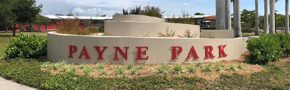
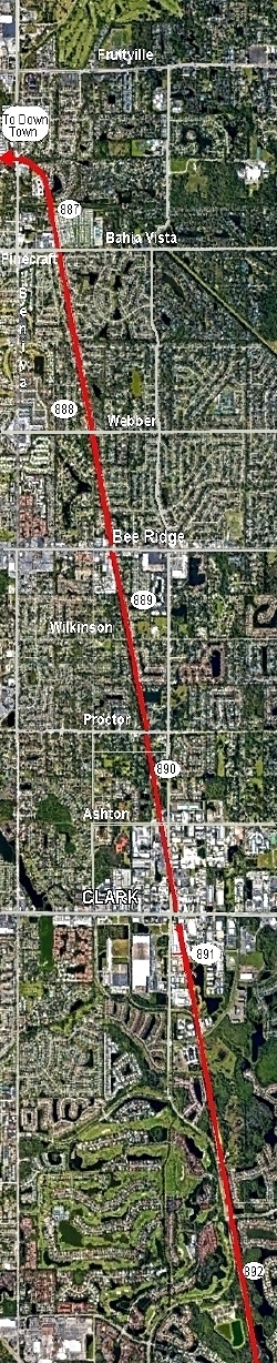
The Sarasota Legacy Trail's actual northern entrance is at heavily traveled Fruitville Rd. just blocks north of Ringling Blvd and before arriving at Payne Park.
Payne Park and its Circus Inspired playground has many amenities and worth a visit by itself. There are all listed on their website. Payne Park is just east of Washington St. (US 301) at the Ford dealer bordered by School Avenue on the west and the Legacy Trail on the east.
The first major street heading south out of the city on the Legacy Trail is Shade Av, and a mile later is S. Tuttle Av. Heading south you will skirt the western edge of the city. For the most part, homes are isolated by greenery although there are new apartments and a mega Cell tower just feet from the trail. You’ll cross two bike only trestles constructed to replace the old dilapidated railroad trestles which run parallel to the new bikeways allowing viewing of the older tracks.
Both trestles cross tributaries of Philippi Creek which is of some renown in Sarasota, as they join and flow all the way to the Intercostal Waterway considerably south of Sarasota.
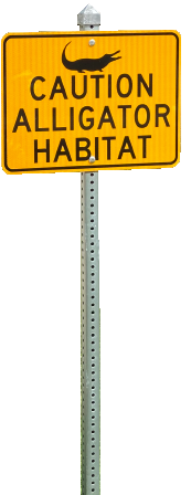
Pinecraft Village
|
|
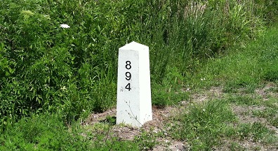
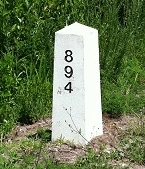
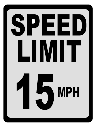
As a reminder, every mile of the Legacy Trail is marked with a granite obelisk. The numbers are in the 800's, beginning at Richmond Virginia, the railroad's one time northern terminus. You'll have to do the math. You will also notice yellow ovals every .5 miles in the center of the roadway. The Milage indicated here is the distance to the US 41 bridge in Venice and to be referenced in emergency. Oh, and the speed limit is 15 mph.
|
|
|
|
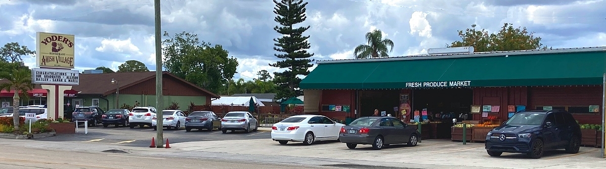
Bahia Vista St. is a perfect beginning or ending of your journey in any case. Just west of the Legacy Trail on Bahia Vista a few blocks, is the Pinecraft Neighborhood, a Mennonite snowbird community with its restaurants, markets and shops. If you haven’t already visited, it’s definitely worth a stop, especially in season and even with your car.
Heading south from Bahia Vista, one will be passing through the older part of Sarasota and behind back yards on both sides with commercial areas popping up, where railroad sidings used to be. Also. major cross streets are more frequent in the north section of the trail. Two are major six lane roads which will have exclusive bike bridges scheduled to be built by 2024. They are Bee Ridge Rd and Clark Rd (St. Rd. 72). Both connect with Interstate 75. Until then they will have traffic lights installed for the bikers. Other east west heavily trafficked four lane roads of concern are Webber Rd with its full facility trailhead. Then their is Wilkinson, and Proctor Rd. and lastly before Clark Rd. the Trailhead at Ashton Rd. which is a full facility area including parking and a fantastic playground which includes a mini zipline for the kids.
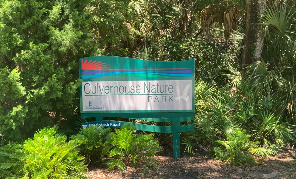
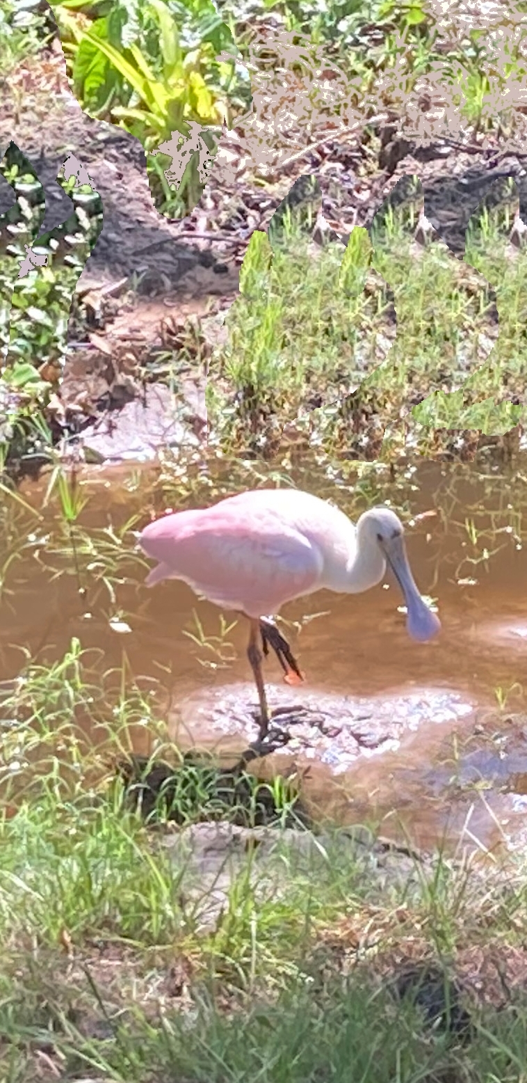
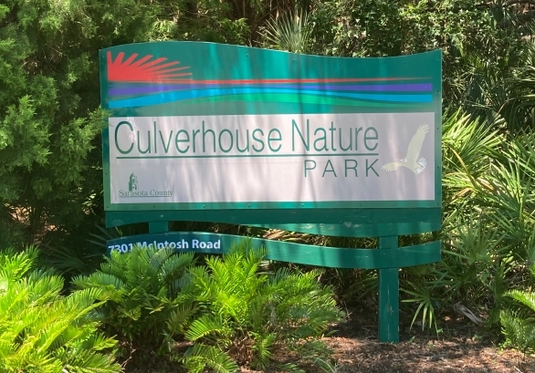
I would say the Culverhouse Nature Park, a mile south of Clark Road (St. Rd. 72 which transverses the state), is the embarkation between urban and rural Sarasota, or at least it used to be when first written about in Part I. In this regard I should profess my purpose for bicycling. In two words, explore and reconnoitre. I dont dress in spandex for the occasion, nor wear a helmet. I'm not trying to hit a new fitbit personal best. Even after all this time, I pedal along and observe as you will no doubt detect in Part I which was my true inspiration as it was virgin territory over a decade ago. Then I would cruise along looking for something I’ve not seen before - a new and unusual tree or flowering plant, an opening in the foliage to a new vista.
South of Clark Rd., things open up and crossroads are few and far between. Surrounding homes are on more spacious lots with farther setbacks. Your first stop will be the Culverhouse Community Garden and Nature Park. It is here where one will jump back in time for the rest and most interesting part of the Legacy Trail.
For me, the Northern extension provides none of the above, it’s just a pleasant path for biking and or access to and from downtown to where Florida begins, Palmer Ranch and south. My Part I, written 12 years ago, is pretty much unedited, pictures and all, to serve as a reminder as how things used to be.
|
|
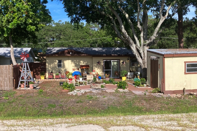
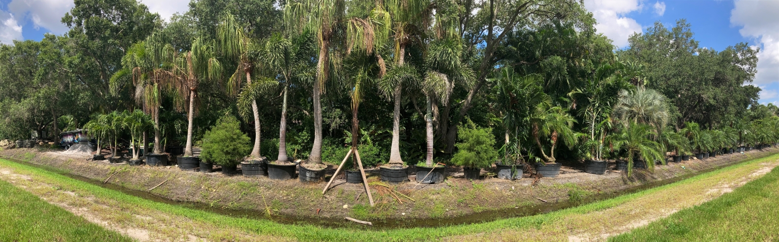
A home along the way
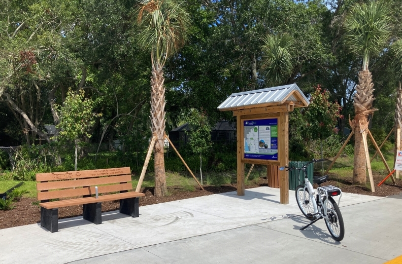
Rest Area at Wilkinson Rd.
A home along the way.
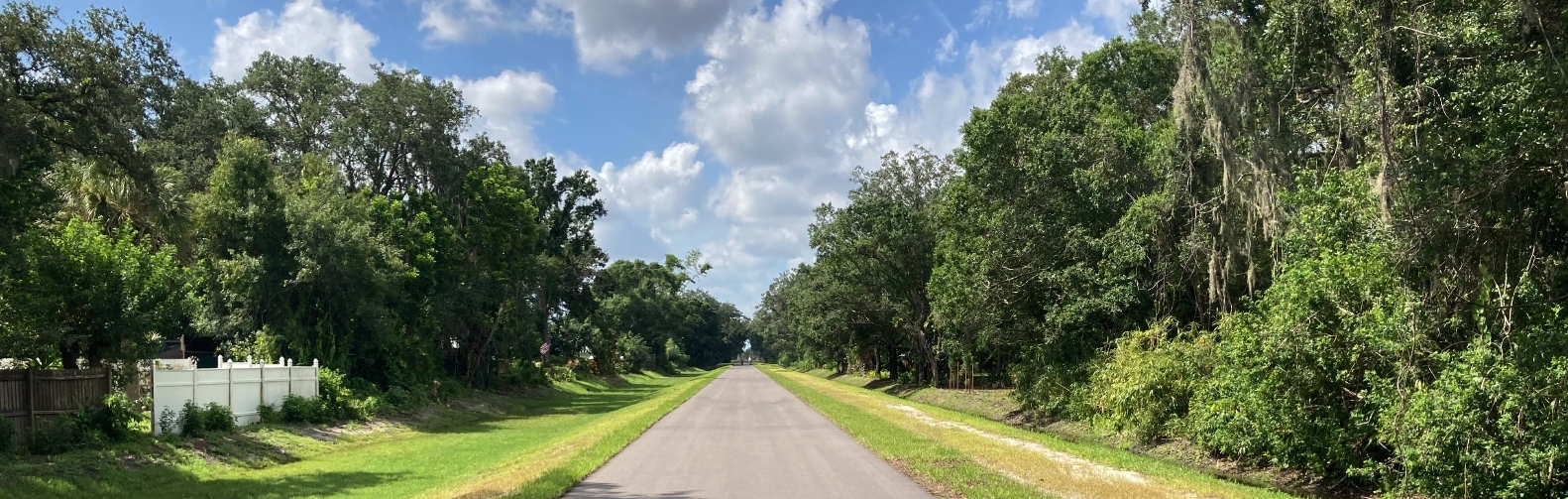
The Northern Trail's width is the same as the original southern Part of the Trail, however there is and unpaved section to one side in most parts. A word of caution: Both sides drop off abruptly 3 feet to culverts which are often filled with water as shown. Click to Enlarge
A home along the way

click
|
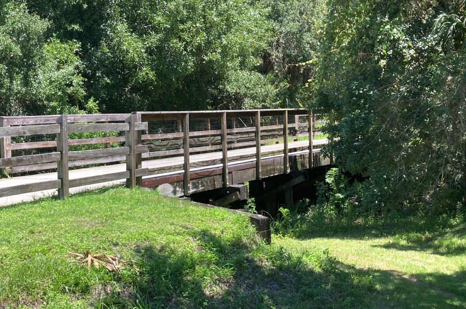
As mentioned, a three foot culvert runs along the North Trail in most parts. It didn't take long for the homeowners whose property abut the trail to build bridges over the culverts. Below are a few. One is quite spectacular.
|
Kiddie Park at the Ashton Trail Head
_______________________________________________
A Family Day Trip
Ashton / Clark Road to Donna Bay
By Sandy Estabrook
Trail Head & Parking
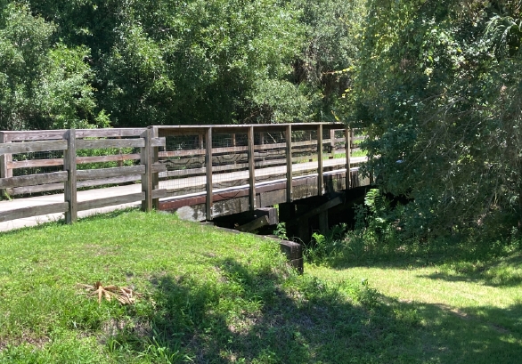
Culverhouse Bridge
|
|
Labor Day Weekend, before this section of the trail officially opened, I Headed south, and skirted the barriers at Ashton and Clark, which were left partially opened. Seemed the workers left the barricades open for our holiday weekend travel. Thanks, I was free at last. From our new home I could now head all the way to points south - my favorite part of the Legacy Trail.
The Clark Rd. traffic light controllers had only started to be installed, so CAUTION was recommended. My guess, they should be up in a week or two , but not later than the end
of the month along with the new trailheads and shelters at Webber and Ashton Roads.
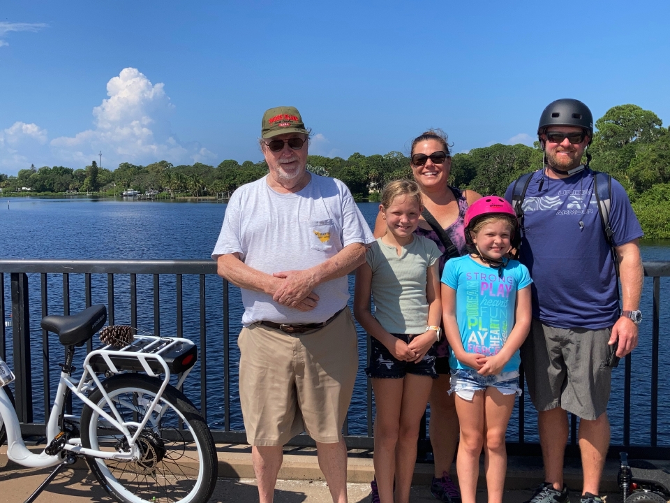
Soon I came upon Sawyer Loop with both sides having no barriers at all. I continued down to Culverhouse Nature Park where I was to meet up with family for the ride. I will define them as Emily & Briana on girls bikes, Mary on a Ladies bike and Mary’s husband, Todd on an electric skate board. I took the lead, on my Pedego Bike, destination Donna Bay.
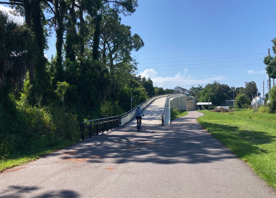
I have not ridden on this part of the trail in years, which I used to do 2-3 times weekly and was anxious to see any changes.. Although I was familiar with the bicycle bridge over US41 in Venice, I never crossed the newest Bridge at Laurel RD in Nokomis. All I will say it is the classic example of: no pain, no gain, with the down hill side, like an amusement park ride.
I think I'll let you see what I mean when you get there. Oh, even my son-in-law made it with his electric skate board but he would pay the price later. The girls had a fun time.
|
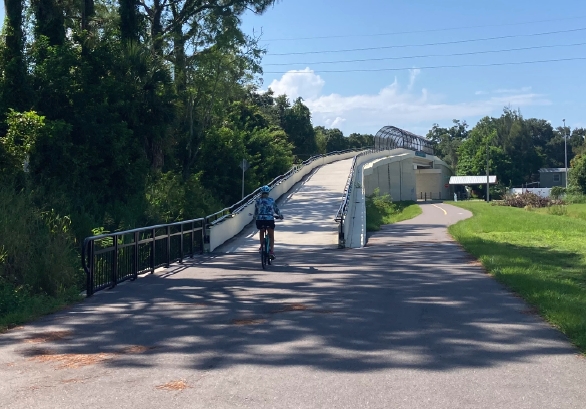
Laurel Road Overpass
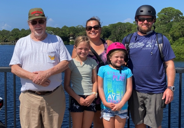
The Gang
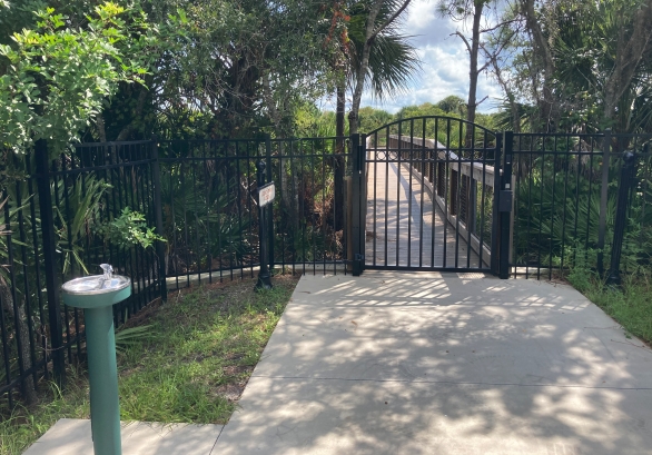
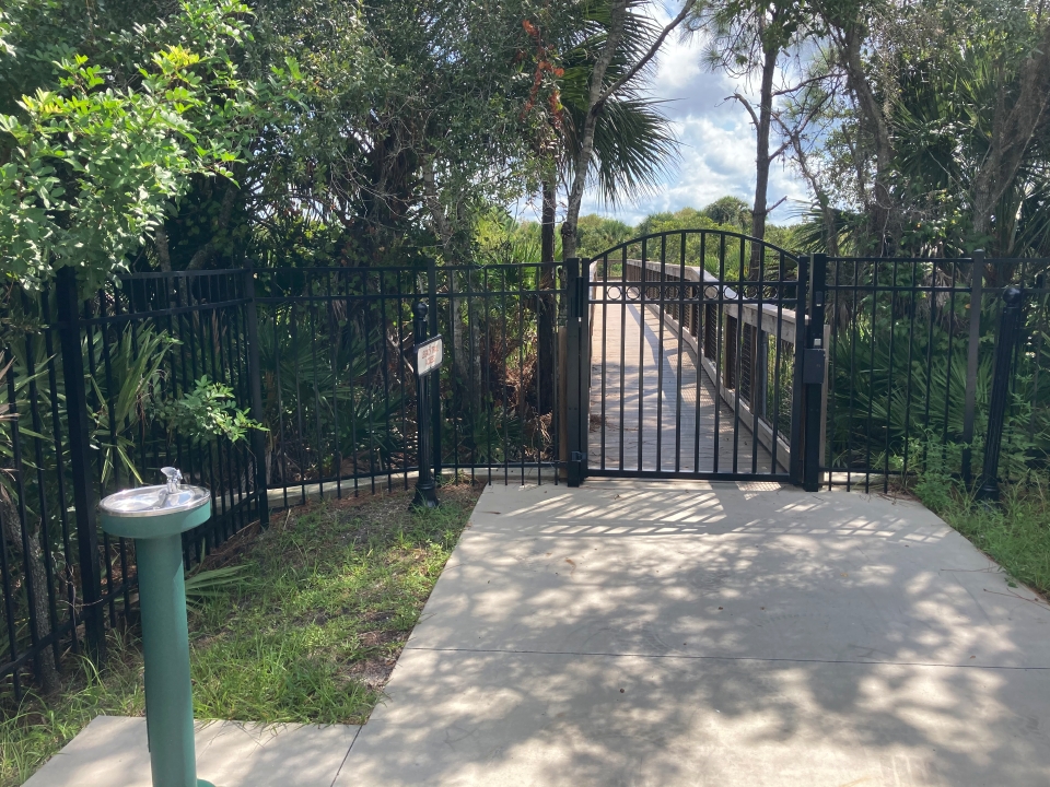
Community Access Gate
|
|
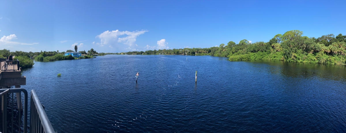
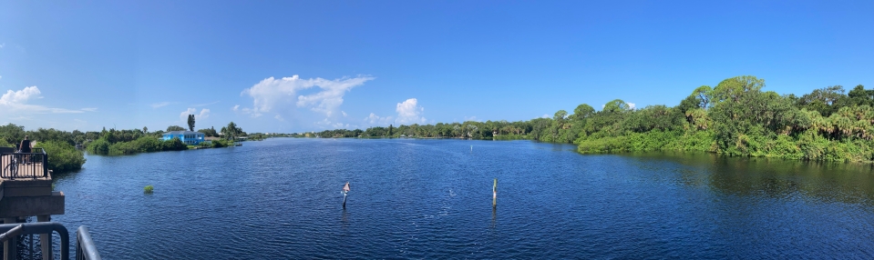
It wasn’t long before we were at midspan atop Dona Bay savoring the views and the breeze of our surroundings. This is one of my favorite spots on the trail and is written about with Video in Part I
After a short rest we headed back north. About mid way, Todd’s skate board’s battery was starting to die. And somewhere around Bay Street it did! While I was anticipating this eventually I was thinking about a solution, which turned out to be towing - simple enough right? So I rounded up some tough scraggy vines that Tarzan used for transportation, wrapped around my seat with Todd grabbing the other end about 5-6 feet behind. I started peddling and turned up my peddle assist and away we went. We did get a lot of strange looks especially crossing at Palmer Ranch Parkway. Shortly their after we were at Culverhouse Nature Park and I continued on to my exit at Wilkinson Rd.
As mentioned I now have a new Pedego Electric Bike. My battery indicator was down to about 1/4th. I figure I can go all the way to Venice and back as I was told by the dealer.
As for any over all changes in the trail in 10 years, that answer would be “Development” on both sides but mostly hidden behind the scrub. One in particular, the Esplanade Legacy Estates has its own private keyed/gated entrance to the trail but you cant see the homes. The over pass of Route 681, approaching from the north, used to be seen from a mile but now has become well shielded by the new growth until almost on top of it.
My last thought, I wonder what kind of bridges are planned for at Clark & Bee Ridge. Construction to begin sometime next year.
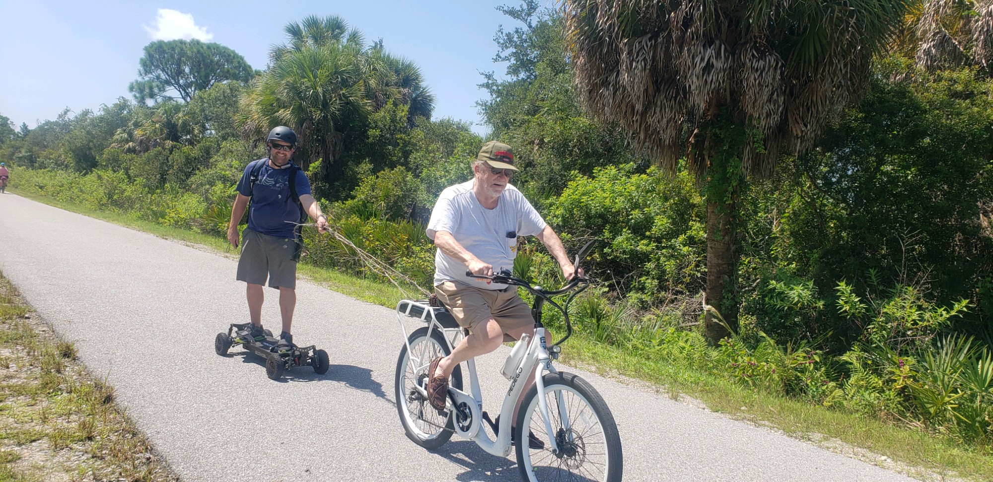
Towing service
|
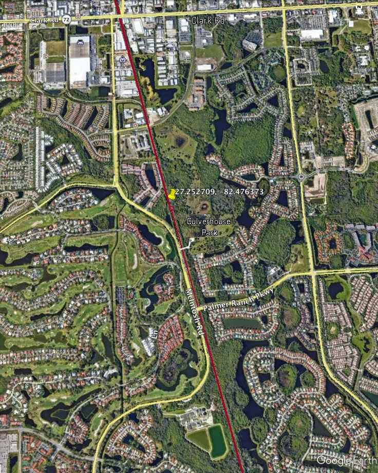
For Legacy Trail lovers, why not buy a piece? We’ve owned a two foot wide swath across the trail, one each at the coordinates below since January 2018. It is located approximately “145 feet north of the edge of the asphalt on the turnaround at the north end of the trail" at that time. A cut and paste of the coordinates (27.252709, -82.476373) into Google Earth will pin point it for you.
If you are interested, it is administered by Friends of the Legacy Trail. 100% of the money received, currently approaching $100,000 from their campaign, will be used to help fund construction and amenities of The Legacy Trail Extension. Learn More here.
In case you are wondering, NO, you can not pick your own coordinates - they just continue on from where last sold and, NO, you can not set up a toll booth.
 © ©
|
|